Overview
Galantas Gold holds exploration and developments rights to the Gairloch Project, a 217 km² mineral licence area in Scotland that covers the Gairloch Schist Belt.
The project hosts the Kerry Road deposit surveyed from 1977 to 1982 by Consolidated Goldfields, and remains underexplored.
Geology
The Archean Rocks of the United Kingdom are located in northwest Scotland and represent part of the North Atlantic Craton, also exposed in Southern Greenland and Labrador in Canada. Within this area in Scotland lies the Paleoproterozoic Loch Maree Group which extends over 30 km and is widely believed to have formed within a juvenile Island arc and/or accretionary tectonic assemblage.
The Kerry Road deposit is a stratabound, Besshi-style, gold-bearing volcanogenic massive sulphide (VMS) deposit exposed at surface. It is one of the oldest known Besshi deposits, similar in age to Sherridon district in Manitoba, Canada. Drilling by GreenOre Gold PLC (GreenOre) in 2018 confirmed the presence of mineralization at Kerry Road. Rock chip sampling conducted by GreenOre in 2018 also identified elevated levels of cobalt in bedrock.
VMS deposits are major sources of zinc, copper, lead, silver and gold. They often form in clusters in areas of ancient underwater volcanic activity. Because of their polymetallic content, VMS deposits are one of the most desirable deposit types for security against fluctuating prices of different metals.
Location map of the Gairloch Project within the Loch Maree Group in Scotland.
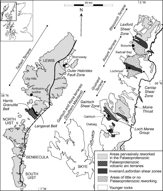
Source: ‘Petrogenesis of rare-metal pegmatites in high-grade metamorphic terrances: A case study from the Lewisian Gneiss Complex of north-west Scotland', June 2016, Precambrian Research 281, by R. Shaw, K.M. Goodenough, N. M.W. Roberts, M.S.A. Horstwood, S.R. Chenery and A.G. Gunn.
Exploration
Based on historical reports from Consolidated Goldfields, the Kerry Road deposit was drill tested in the late 1970s to early 1980s, where 87 drill holes (9,189 metres) were drilled to identify the deposit, which is reportedly open along strike and at depth. Work was abandoned in 1982 due to low metal prices at the time. Other than academic work and national geological surveys, commercial exploration was not conducted over the region until 2018 when GreenOre obtained the licence. A single short hole was drilled in 2018.
Historical Exploration Highlights*:
- Drill hole GBH39 intersect of 11.29 grams per tonne (g/t) gold (Au), 2.44 g/t silver (Ag), 0.58% copper (Cu) and 0.19% zinc (Zn) over 16 metres (80 to 96 metres downhole).
- Drill hole GBH30 intersect of 3.16 g/t Au, 3.39 g/t Ag, 0.90% Cu and 0.51% Zn over 18 metres (32.82 to 50.82 metres downhole).
- Drill hole GBH68 intersect of 1.5 g/t Au, 16.5 g/t Ag, 5.92% Cu and 0.54% Zn over 6 metres (261.88 to 267.88 metres downhole).
- District-scale potential with an outcrop tested by the British Geological Survey (BGS) 10 km from historical drilling returning 4 g/t Au, 1.5% Cu and 2.3% Zn.
- Elevated levels of cobalt identified in stream sampling and in outcrop up to 410 g/t.
*True widths not known. Historical drill hole data obtained from logs written by Consolidated Gold Fields Limited in 1979 and 1980, scanned copies supplied by the British Geological Survey.
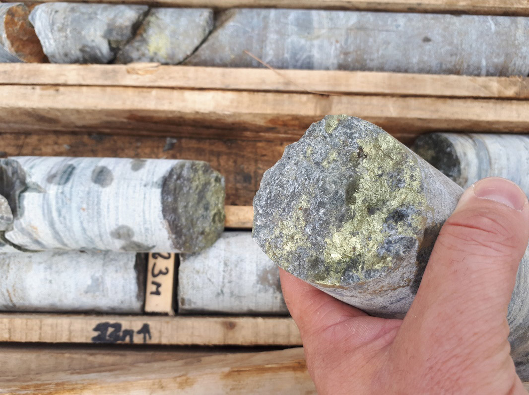
Core from hole 18-G-01 drilled by GreenOre Gold Plc grading 1 g/t Au, 0.9% Cu and 0.6% Zn over 17 metres (19 to 36 metres downhole) including 8 metres at 1.8g/t Au, 1.4% Cu and 0.7% Zn (22 to 30 metres downhole). Photo and data obtained from GreenOre.
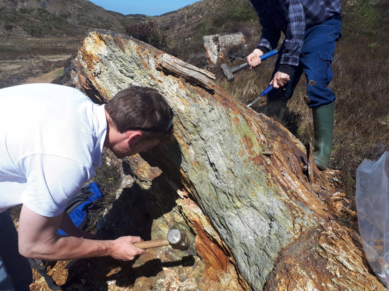
Main outcrop at Kerry Road deposit grading 4.09 g/t Au, 6 g/t Ag, 1.58% Cu and 2.27% Zn. Photo and data obtained from GreenOre.
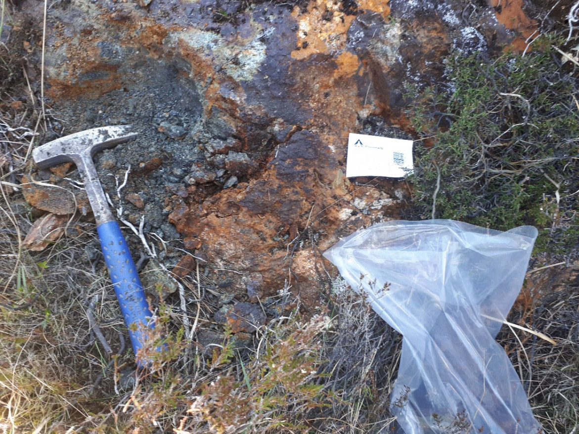
Second outcrop at Kerry Road deposit with visible chalcopyrite, 30 metres northwest of main outcrop, grading 2.16 g/t Au, 14 g/t Ag, 5.23% Cu and 0.30% Zn. Photo and data obtained from GreenOre.
A number of follow-up targets have also been identified by Galantas from regional geophysical and geochemical datasets supplied by the BGS. It has been observed that the main minerals of interest are chalcopyrite, sphalerite, pyrite and pyrrhotite found within quartz-carbonate schist. A review of the historical assays indicates that gold is often associated with higher copper grades. Recent academic studies, fieldwork and government surveys have demonstrated the wider potential of the area, which to date has had no commercial mining of any scale, despite the highly prospective nature of the geology.
The BGS recorded an outcrop of 4 g/t Au in their MRP146 report associated with a significant geophysical anomaly approximately 10 km south of the Kerry Road deposit, but the area remains untested. The G-base stream sediment data collected in the 1970s by the BGS over the wider area have also shown high occurrences of copper, zinc and cobalt. Multiple historical geophysical anomalies identified by the BGS in their regional magnetics and gravity surveys remain untested. No official resource model has been completed to date.
Drill hole locations for holes GBH39, BGH30, GBH68 and 18-G-01.
|
Hole |
Easting |
Northing |
Elevation (ft) |
Azimuth (grid north) |
Dip |
Depth |
|
GBH30 |
183879 |
872512 |
148 |
223 |
-45 |
57.30 |
|
GBH39 |
183912 |
872521 |
256 |
223 |
-53 |
102.50 |
|
GBH68 |
184181 |
872339 |
126 |
229 |
-74 |
278.95 |
|
18-G-01 |
183807 |
872534 |
146 |
223 |
-45 |
55.00 |
Note: Easting and northings digitized from historical map as historical logs only recorded location on a local grid.